An Bord Pleanála approved the Foynes to Limerick Road (including Adare Bypass) scheme in August 2022.
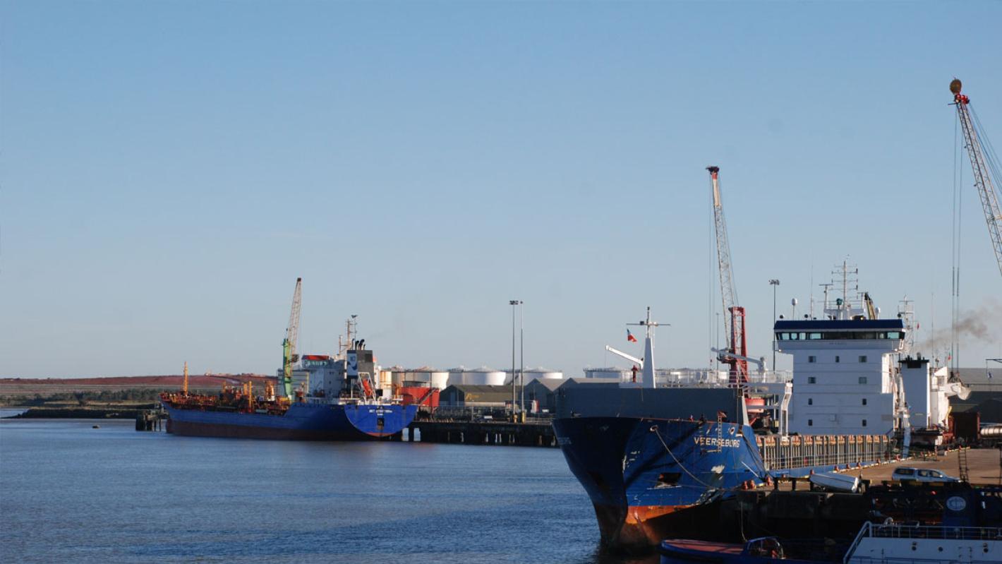
Providing a high quality road to connect the Port of Foynes to the Trans European Road Network (TEN-T) near the city of Limerick
An Bord Pleanála approved the Foynes to Limerick Road (including Adare Bypass) scheme in August 2022.
Map showing the route of the proposed development.
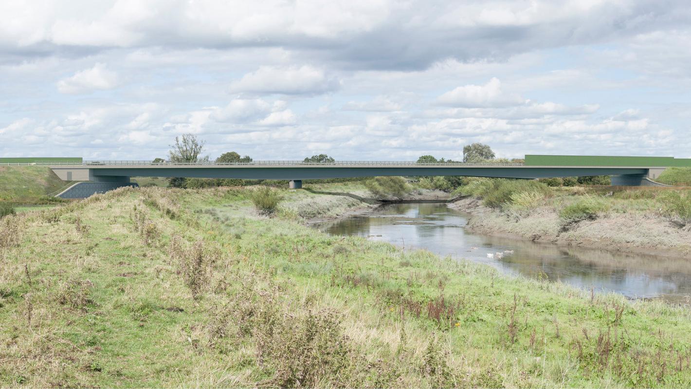
The proposed road development includes a 200m+ long bridge over the River Maigue, which is designated as part of the Lower River Shannon Special Area of Conservation (SAC).

Roughan & O’Donovan-AECOM is advancing the development of this scheme, linking the Port of Foynes with the M7/N18 at Limerick, from feasibility and route selection, through design, to environmental and planning.
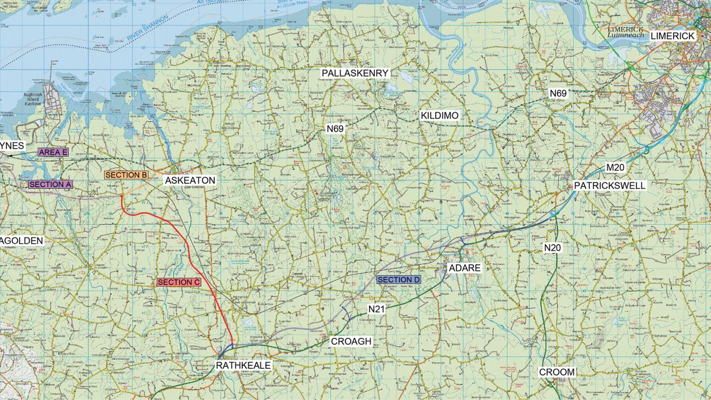
The new road development will link from Foynes to the N21 at Rathkeale, and from there it will replace the section of the existing N21 route between Rathkeale and Attyflin (Patrickswell), including a bypass of Adare.
The scheme will greatly improve connectivity within County Limerick and the wider mid-west region, boosting competitiveness for inward investment and supporting the ongoing development of the tourism sector in the area.
In 2014, Limerick City and County Council engaged ROD-AECOM to undertake the planning, design and environmental assessment of the proposed development.
In 2016, a route selection report was published, and the design of the proposed development was subsequently progressed by ROD-AECOM.
In December 2019, Limerick City and County Council submitted an Environmental Impact Assessment Report, Natura Impact Statement and Compulsory Purchase Order to An Bord Pleanála for the proposed development.
Following a request from An Bord Pleanála, further information was submitted in December 2020.
A virtual oral hearing was held in February 2021, and An Bord Pleanála granted formal approval for the scheme in August 2022.
The total length of the proposed road development is 35km. It comprises 15.6km of Type 2 dual carriageway from Foynes to Rathkeale, 1.9km of single carriageway road from Ballyclogh towards Askeaton and 17.5km of motorway standard dual carriageway from Rathkeale to Attyflin.
Junctions will be provided at Foynes, Ballyclogh, Askeaton, Rathkeale, Croagh and Adare, with a heavy goods vehicle service area also being provided at the Foynes terminus.
The development includes five large river bridges, including a bridge in excess of 200m over the River Maigue, which is designated as part of the Lower River Shannon Special Area of Conservation (SAC). There will also be three bridges over the disused Limerick to Foynes railway line, for which there is a separate EU objective to reinstate a freight railway link to Foynes Port.
The preferred route for the scheme will be a 16km dual carriageway motorway from east of Adare to Rathkeale and a 15.5km single carriageway from Foynes to Rathkeale.
As part of the route selection and design process, we undertook:
With a constraints study area of over 425 sq. km., a substantial number of environmental and physical constraints had to be collated and recorded to assist in the development of route options, including:
The complex hydrogeological environment, comprising numerous groundwater bodies and groundwater-dependent terrestrial ecosystems, added further complexity.